


Product code: French illustrated school geography cheapest economy map double sided
Maps content contains: food, cows, animals, clothes, shoes, grain, fish, sheep, vegetables, fruits, strawberries, cheese, ships, boats, sea, Atlantic ocean, pigs, industry, farmers.
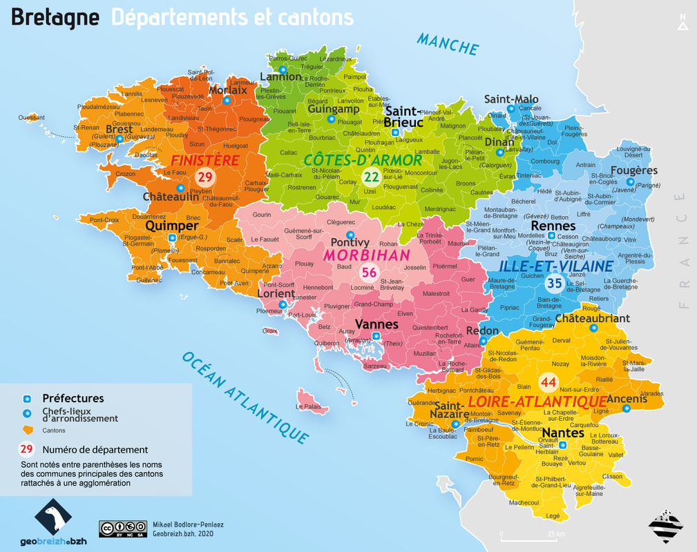
Region: Nantes, Rennes, Nazaire, Brest, Angers, Tours, Bourges, Le Mans, Nevers, Les Pays de la Loire, Lorleans, Laval, Malo, Vannes, Lorient, Bretagne et Vendee.
Double sided vintage school card.
Tableau 11 & 12 carte economique
Imprimerie Georges Lang
La cheapest Maison des Instituteurs, Saint Germain en Laye
Size: 90,5 cm x 79 cm